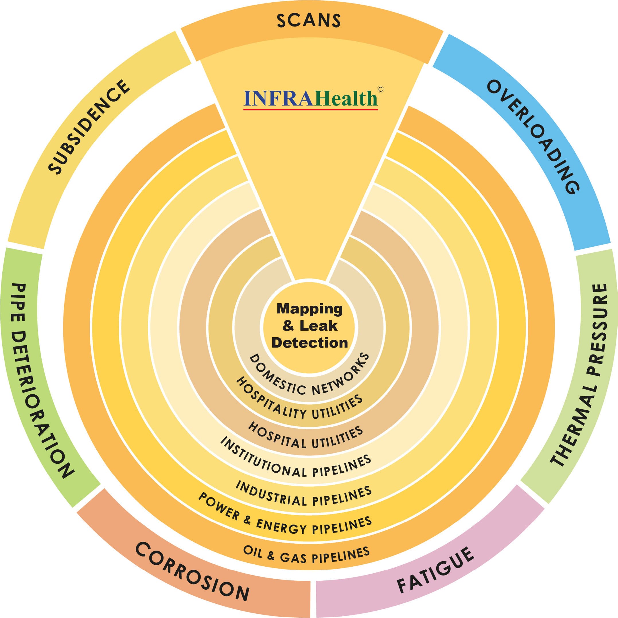
Pipe mapping and leak detection for live utility and process networks.
Starmass maps, verifies, monitors, and diagnoses liquid, gas, and thermal pipeline systems across indoor, buried, and industrial environments. The service is built for owners who need route certainty, leak localization, and operational visibility without unnecessary disruption.

From source to system: complete fluid integrity audits.
Pipeline mapping and route identification
Leakage detection and condition assessment
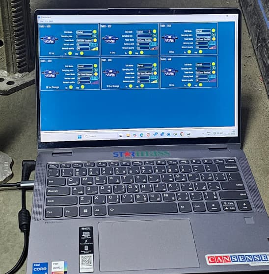
Smart sensors and scanning systems
Digital asset integration and analytics
Rapid response and isolation readiness
What this capability covers
This capability combines route verification, leak detection, subsurface scanning, data integration, and operational response planning in one delivery model. It is intended for owners who need both field evidence and decision-ready outputs.
Pipeline mapping and route identification
Locate, trace, and verify active or buried networks so teams know where the system actually runs, what it is made of, and how it relates to surrounding utilities.
Leakage detection and condition assessment
Localize loss conditions and identify abnormal flow, pressure, vibration, temperature, or infiltration behavior across operating networks.
Smart sensors and scanning systems
Deploy the right mix of acoustic, thermal, geophysical, fiber-optic, and telemetry tools for the material, pressure regime, and access constraints.
Digital asset integration and analytics
Turn survey and leak evidence into GIS layers, digital twins, dashboards, and lifecycle reporting that operations teams can actually use.
Rapid response and isolation readiness
Support zoning, alerting, and district isolation planning so response actions can happen earlier and with less uncertainty.
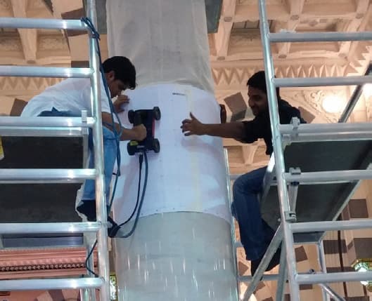
Indoor pipeline mapping and leak detection
For above-ground, embedded, and indoor utility networks, Starmass maps the system, verifies the route and geometry, and diagnoses leak conditions across water, oil, gas, chilled-water, and sewage environments. The objective is not just a survey record. It is a usable digital picture of the live network.
Transforming field intelligence into actionable digital insight.
Mapping and verification
Route identification and depth profiling
Locate metallic and non-metallic pipelines, ducts, and conduits with usable route confidence.
3D subsurface mapping
Combine GPR, electromagnetic, and LiDAR inputs to visualize buried or concealed utility geometry.
As-built verification and digital documentation
Capture route alignment, depth, and geometry for record drawings and updated documentation.
Utility conflict and cross-service assessment
Identify interference between parallel or intersecting utilities before maintenance or retrofit work.
Digital twin and GIS integration
Link spatial survey data with design records, maintenance history, and control-system context.
Pipeline material classification
Differentiate metallic, composite, and thermoplastic materials to support correct detection strategy and maintenance planning.
Leak detection and condition assessment
Pressurized water and chilled-water pipelines
Use correlation, hydrophones, and fiber-optic DTS for leak localization.
Oil and gas transmission lines
Apply smart pigging, pressure transient analysis, and acoustic monitoring.
Wastewater and sewage systems
Use CCTV, smoke and dye testing, and flow-balance analysis for infiltration and exfiltration conditions.
District cooling and energy networks
Use thermal imaging, DTS sensors, and pressure monitoring to identify loss conditions and abnormal behavior.
Chemical and industrial pipelines
Use vibration-based leak detection and ATEX-rated monitoring approaches where required.
Cross-network leak correlation
Combine acoustic and hydraulic data to isolate recurring or hard-to-pinpoint leak conditions.
Indoor systems
Precision mapping, smart leak detection, and real-time protection for embedded networks.
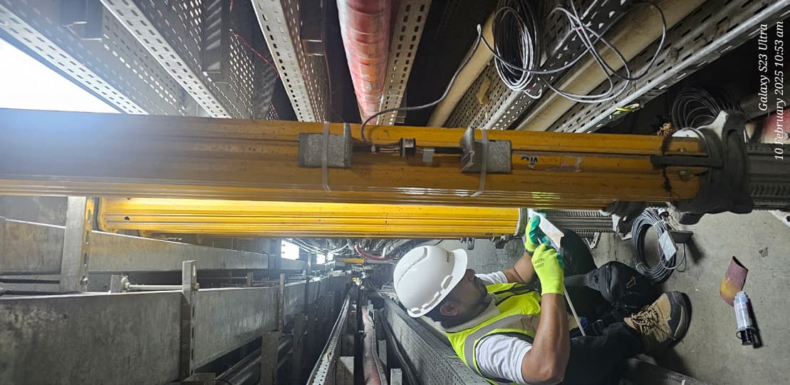
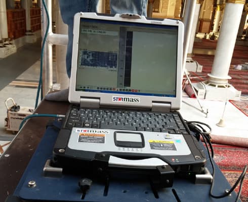
Embedded utilities mapping in Madinah
Leak detection system design in Makkah
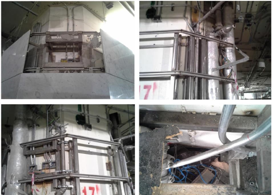
Underground pipe mapping in Jeddah
Corridor scanning
Buried-route mapping and leak localization for high-consequence outdoor assets.
Underground pipe mapping in Jeddah
Leakage audit on a refinery potable-water lake
Underground pipe mapping in Jeddah
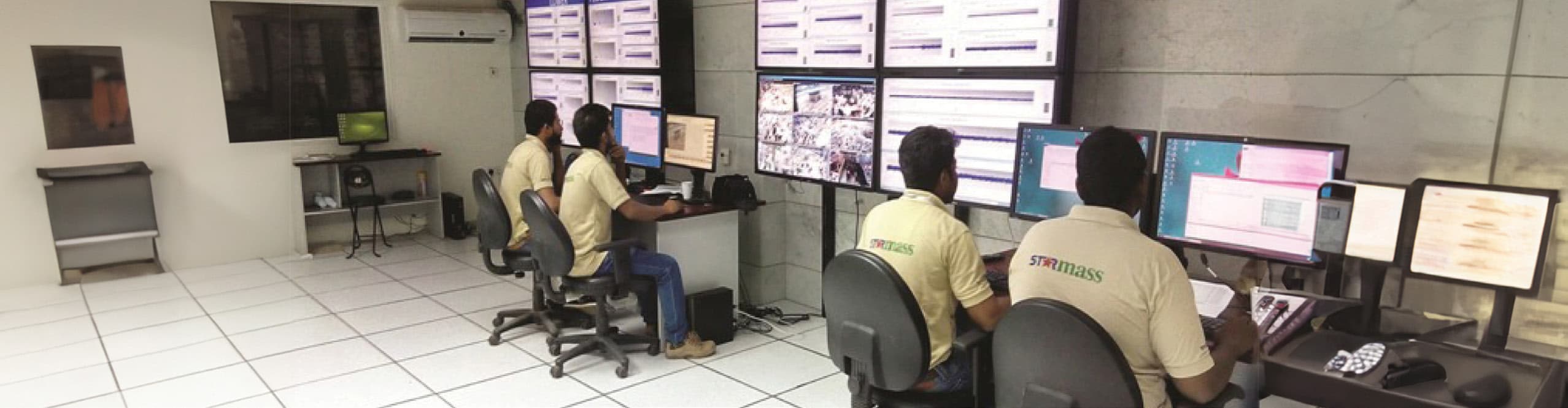
Industrial audit and control-room review
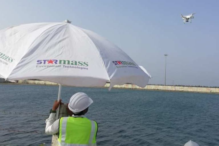
Outdoor leak detection and buried corridor mapping
For buried utilities and pipeline corridors, Starmass integrates acoustic, geophysical, and digital mapping methods to locate leaks, trace routes, and improve operational visibility across water, chilled-water, wastewater, and industrial distribution networks.
Mapping and leakage analytics form the foundation of a digital integrity audit, linking every buried asset to its precise geospatial footprint.
Pipeline leak detection
These methods are selected according to pressure regime, material type, access condition, and network criticality.
Acoustic correlation and ground microphones
Detect and pinpoint leaks on pressurized networks where direct access is limited.
Smart pigging and hydrophone sensors
Capture internal condition and flow behavior across longer or more complex mains.
Pressure transient analysis
Interpret bursts, surge events, and subtle leak signatures across long-distance pipelines.
Fiber-optic Distributed Acoustic Sensing
Monitor vibration and abnormal corridor behavior over extended buried runs.
Thermal imaging through UAV or fixed-mast deployment
Identify hot or chilled-water anomalies across large outdoor surfaces.
Tracer gas pinpoint testing using helium or hydrogen
Confirm leak locations in non-metallic or low-pressure systems with minimal excavation.
Pipeline mapping and route identification
Ground Penetrating Radar
Non-destructive mapping of buried utilities and voids.
Electromagnetic pipe tracing
Trace metallic and non-metallic pipelines with high positional accuracy.
GPS and GIS survey integration
Correlate field mapping into digital twins and asset registers.
Depth and alignment profiling
Capture topography, bends, and as-built deviations.
Defect correlation layering
Link route data to leak, corrosion, or insulation defect locations.
3D subsurface visualization
Overlay mapped utilities and anomalies in a unified digital view.
District and network monitoring
Real-time flow and pressure telemetry nodes
Build live visibility into distributed pipe networks and critical corridors.
Smart valve districting and isolation control
Support faster containment and more controlled response pathways.
Cloud-based hydraulic balance analytics
Compare expected and observed performance across the wider network.
GIS-integrated leak and flow mapping dashboards
Combine route data, flow signals, and leak evidence in one operational view.
Underground and utility corridor scanning
Multi-technology GPR and electromagnetic detection
Map corridor geometry using overlapping scan methods rather than one isolated signal.
Infrared thermography for buried leaks
Locate buried loss conditions through surface temperature anomalies.
DTS and DAS fiber-optic trench monitoring
Monitor buried corridors for stress, vibration, or thermal variation.
Tracer gas pinpoint testing for non-metallic or low-pressure systems
Validate suspected leak zones where conventional acoustic methods are weaker.
From field evidence to operational visibility
Mapping and leak detection only become valuable at the organization level when route data, alarms, and condition findings are connected to the systems owners already use for operations, maintenance, and compliance.
Integrated view
Route records, alarm signals, and condition findings aligned in one operating layer.
Operational integration
Digital twin and GIS integration
Link spatial survey data with design records, maintenance history, and control environments.
Operational integration
Centralized GIS dashboard
Bring mapping, leak, and condition data into one operating view.
Operational integration
BMS and SCADA connectivity
Push alarms and visibility into the systems operations teams already monitor.
Analytics and lifecycle reporting
Cloud-based data fusion
Aggregate acoustic, thermal, hydraulic, and spatial inputs into one interface.
Analytics and lifecycle reporting
AI-driven condition prediction
Identify recurring leak patterns, pressure anomalies, and likely reoccurrence behavior.
Analytics and lifecycle reporting
Lifecycle risk reporting
Generate compliance-ready reports with maps, condition summaries, and performance evidence.
Technology stack selected by network condition and access
No single instrument fits every network. Starmass selects indoor and outdoor toolchains based on material, fluid, pressure profile, accessibility, and response requirement.
Indoor technologies
Instrumentation for mechanical rooms, risers, service corridors, basements, and embedded utility spaces.
IoT leak cables and spot sensors
Continuous floor or tray monitoring for mechanical rooms, basements, and risers.
Clamp-on ultrasonic flowmeters
Detect abnormal flow or imbalance in HVAC and chilled-water loops.
Acoustic correlators and listening devices
Pinpoint pressurized line leaks in risers and utility rooms.
Infrared and thermal imaging
Identify temperature anomalies on ceilings or mechanical piping.
CCTV and endoscopic inspection
Internal visual checks for cracks, joints, and infiltration or exfiltration conditions.
Dye and UV tracing
Confirm leak paths in plumbing and chilled-water systems.
Fiber-optic DTS
Temperature monitoring of buried chilled-water lines or tunnels.
Outdoor technologies
Geophysical, acoustic, thermal, and corridor-scale monitoring tools for buried networks and large distribution assets.
Acoustic correlation and hydrophones
Detect and locate leaks on buried pressurized pipelines.
Pressure transient analysis
Identify bursts or surge conditions in long-distance mains.
Fiber-optic DAS and DTS
Monitor vibration, stress, and temperature in buried corridors.
Ground Penetrating Radar
Map buried pipes and detect voids or wet zones.
Electromagnetic and RF pipe locators
Trace metallic and non-metallic pipelines accurately.
Thermal and UAV infrared imaging
Detect hot or chilled-water leaks across surface networks.
Tracer gas
Pinpoint leaks in non-metallic or low-pressure systems.
Smart pigging and ILI
Map internal wall thickness and defect conditions for large mains.
GPS and GIS mapping integration
Create digital route models with route and defect overlays.
End-to-end service workflow
The delivery model moves from route certainty to operational response in a structured sequence.
01
Site survey and baseline mapping
Establish route location, material assumptions, access constraints, and baseline network conditions.
02
Sensor deployment and network integration
Install and connect the appropriate sensing, telemetry, tracing, and survey layers for the target environment.
03
Real-time monitoring and alerting
Stream condition signals into thresholds, alarms, and review workflows for live visibility.
04
Automated district isolation
Support valve zoning, fault isolation, and response logic where district segmentation or rapid containment matters.
05
Reporting and maintenance planning
Deliver updated records, risk findings, maintenance priorities, and digital outputs that fit long-term asset management.
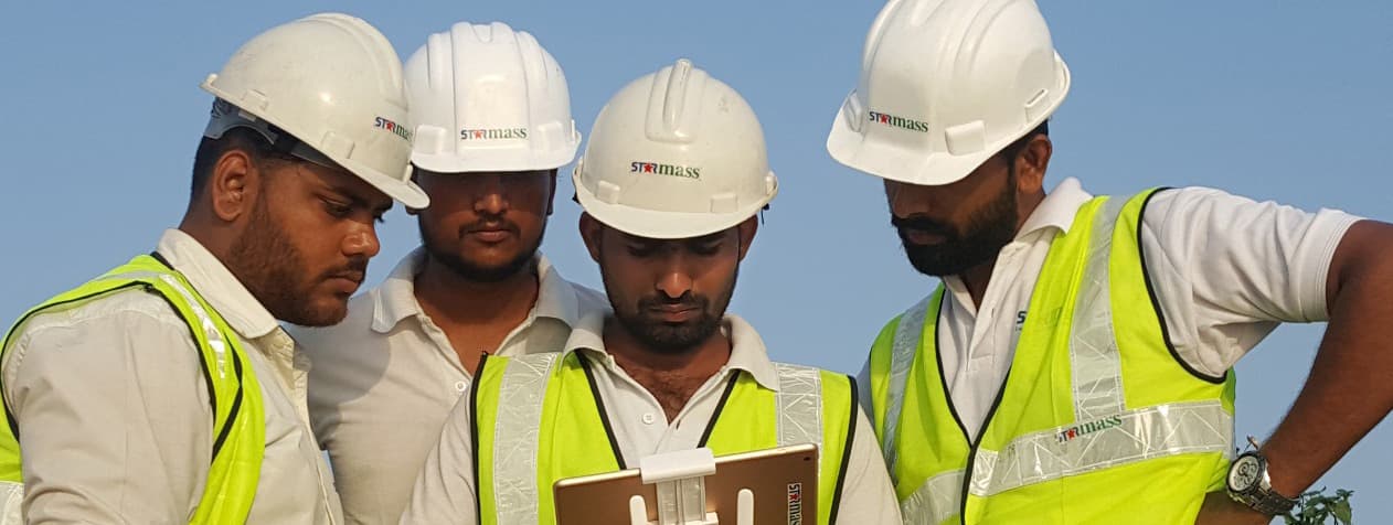
Field proof from verified audits and installations
The page uses source imagery from brochure-supported project work to show embedded utility mapping, industrial audit work, buried-corridor scanning, and live leak-investigation conditions.
Verified project imagery
Leakage audit on a refinery potable-water lake
Verified project imagery
Embedded utilities mapping in Madinah
Verified project imagery
Leak detection system design in Makkah
Verified project imagery
Underground pipe mapping in Jeddah
Verified project imagery
Industrial audit and control-room review
All project images shown are from verified Starmass installations, investigations, and audits.
Start the conversation
Need route certainty, leak localization, or a broader fluid integrity audit?
Talk to Starmass about a live network, buried corridor, district system, or industrial asset. We can help define the right mapping, leak detection, and digital integration approach for the operating environment.